Phenomenon Multispectral signature
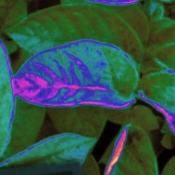

Full resolution source image

EXIF- image info
Filename – DSC00136_Sample__x1994_y2596_.jpg
Make – SONY Model – AgroWing_ILCE-QX1
Orientation – Top left
DateTime – 2017:07:12 13:10:43
ExifOffset – 124
ExposureTime – 1/250 seconds
FNumber – 6.00
ExposureProgram – Shutter priority ISO
SpeedRatings – 100 DateTimeOriginal – 2017:07:12 13:10:43
LightSource – Daylight FocalLength – 25.00 mm
FocalPlaneXResolution – 235.17 FocalPlaneYResolution – 235.84
Focal Plane Resolution Unit – No unit
GPS information:
GPSLatitudeRef – N
GPSLatitude – 52 36 55.287998 (52.615358)
GPSLongitudeRef – E GPSLongitude – 16 37 51.296001 (16.630916)
GPSAltitudeRef – 436 (other)
GPSAltitude – 117 m
Present on Google Maps
Phenomenon Multispectral signature
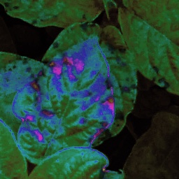

Full resolution source image

EXIF- image info
Filename – DSC00136_Sample__x1958_y1798_.jpg
Make – SONY
Model – AgroWing_ILCE-QX1
Orientation – Top left
DateTime – 2017:07:12 13:10:43
ExifOffset – 124
ExposureTime – 1/250 seconds
FNumber – 6.00
Exposure Program – Shutter
priority ISO
Speed Ratings – 100
Date Time Original – 2017:07:12 13:10:43
LightSource – Daylight
Focal Length – 25.00 mm
Focal Plane X Resolution – 235.17
Focal Plane Y Resolution – 235.84
Focal Plane Resolution Unit – No unit
GPS information:
GPS Latitude Ref – N
GPS Latitude – 52 36 55.287998 (52.615358)
GPS LongitudeRef – E
GPS Longitude – 16 37 51.296001 (16.630916)
GPS Altitude Ref – 436 (other)
GPS Altitude – 117 m
Present on Google Maps
Phenomenon Multispectral signature
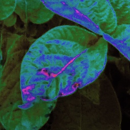

Full resolution source image

EXIF- image info
Filename – DSC00136_Sample__x1658_y2166_.jpg
Make – SONY Model – AgroWing_ILCE-QX1
Orientation – Top left
DateTime – 2017:07:12 13:10:43
ExifOffset – 124 ExposureTime – 1/250 seconds
FNumber – 6.00
Exposure Program – Shutter priority
ISO Speed Ratings – 100
Date Time Original – 2017:07:12 13:10:43
Light Source – Daylight
Focal Length – 25.00 mm
Focal Plane XResolution – 235.17
Focal Plane YResolution – 235.84
Focal Plane ResolutionUnit – No unit
GPS information:
GPS LatitudeRef – N
GPS Latitude – 52 36 55.287998 (52.615358)
GPS Longitude Ref – E
GPS Longitude – 16 37 51.296001 (16.630916)
GPS Altitude Ref – 436 (other)
GPS Altitude – 117 m
Present on Google Maps
Phenomenon Multispectral signature


Full resolution source image

EXIF- image info
Filename – DSC00136_Sample__x1650_y1416_.jpg
Make – SONY
Model – AgroWing_ILCE-QX1
Orientation – Top left
DateTime – 2017:07:12 13:10:43
Exif Offset – 124
Exposure Time – 1/250 seconds
FNumber – 6.00
Exposure Program – Shutter priority
ISO Speed Ratings – 100
Date Time Original – 2017:07:12 13:10:43
Light Source – Daylight FocalLength – 25.00 mm
Focal Plane XResolution – 235.17
Focal Plane YResolution – 235.84
Focal Plane Resolution Unit – No unit
GPS information:
GPS Latitude Ref – N
GPS Latitude – 52 36 55.287998 (52.615358)
GPS Longitude Ref – E
GPS Longitude – 16 37 51.296001 (16.630916)
GPS Altitude Ref – 436 (other)
GPS Altitude – 117 m
Present on Google Maps
Phenomenon Multispectral signature
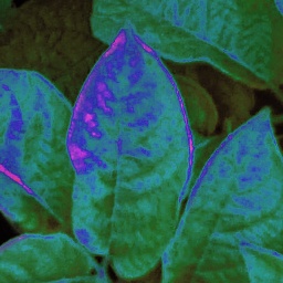

Full resolution source image

EXIF- image info
Filename – DSC00136_Sample__x1618_y2572_.jpg
Make – SONY Model – AgroWing_ILCE-QX1
Orientation – Top left
DateTime – 2017:07:12 13:10:43
Exif Offset – 124 ExposureTime – 1/250 seconds
FNumber – 6.00
Exposure Program – Shutter priority
ISO Speed Ratings – 100
Date Time Original – 2017:07:12 13:10:43
Light Source – Daylight
Focal Length – 25.00 mm
Focal PlaneX Resolution – 235.17
Focal PlaneY Resolution – 235.84
Focal Plane Resolution Unit – No unit
GPS information:
GPS LatitudeRef – N
GPS Latitude – 52 36 55.287998 (52.615358
GPS Longitude Ref – E
GPS Longitude – 16 37 51.296001 (16.630916)
GPS Altitude Ref – 436 (other)
GPSAltitude – 117 m
Present on Google Maps
Phenomenon Multispectral signature
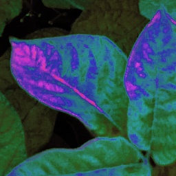

Full resolution source image

EXIF- image info
Filename – DSC00136_Sample__x1498_y2584_.jpg
Make – SONY
Model – AgroWing_ILCE-QX1
Orientation – Top left
Date Time – 2017:07:12 13:10:43
Exif Offset – 124
Exposure Time – 1/250 seconds
FNumber – 6.00
Exposure Program – Shutter priority
ISO Speed Ratings – 100
Date Time Original – 2017:07:12 13:10:43
Light Source – Daylight
Focal Length – 25.00 mm
Focal Plane X Resolution – 235.17
Focal Plane Y Resolution – 235.84
Focal Plane ResolutionUnit – No unit
GPS information:
GPS Latitude Ref – N
GPS Latitude – 52 36 55.287998 (52.615358)
GPS Longitude Ref – E
GPS Longitude – 16 37 51.296001 (16.630916)
GPS Altitude Ref – 436 (other)
GPS Altitude – 117 m
Present on Google Maps
Phenomenon Multispectral signature


Full resolution source image

EXIF- image info
Filename – DSC00136_Sample__x1330_y2074_.jpg
Make – SONY
Model – AgroWing_ILCE-QX1
Orientation – Top left
Date Time – 2017:07:12 13:10:43
Exif Offset – 124
Exposure Time – 1/250 seconds
Number – 6.00
Exposure Program – Shutter priority
ISO Speed Ratings – 100
Date Time Original – 2017:07:12 13:10:43
Light Source – Daylight
Focal Length – 25.00 mm
Focal Plane X Resolution – 235.17
Focal Plane Y Resolution – 235.84
Focal Plane Resolution Unit – No unit
GPS information:
PS Latitude Ref – N
GPS Latitude – 52 36 55.287998 (52.615358)
GPS Longitude Ref – E
GPS Longitude – 16 37 51.296001 (16.630916)
GPS Altitude Ref – 436 (other)
GPS Altitude – 117 m
Present on Google Maps
Phenomenon Multispectral signature


Full resolution source image

EXIF- image info
Filename – DSC00136_Sample__x1058_y2878_.jpg
Make – SONY
Model – AgroWing_ILCE-QX1
Orientation – Top left
DateTime – 2017:07:12 13:10:43
Exif Offset – 124
ExposureTime – 1/250 seconds
FNumber – 6.00
Exposure Program – Shutter priority
ISO Speed Ratings – 100
Date Time Original – 2017:07:12 13:10:43
Light Source – Daylight
Focal Length – 25.00 mm
Focal Plane X Resolution – 235.17
Focal Plane Y Resolution – 235.84
Focal Plane ResolutionUnit – No unit
GPS information:
GPS Latitude Ref – N
GPS Latitude – 52 36 55.287998 (52.615358)
GPS Longitude Ref – E
GPS Longitude – 16 37 51.296001 (16.630916)
GPS Altitude Ref – 436 (other)
GPS Altitude – 117 m
Present on Google Maps
Phenomenon Multispectral signature


Full resolution source image

EXIF- image info
Filename – DSC00136_Sample__x676_y1722_.jpg
Make – SONY
Model – AgroWing_ILCE-QX1
Orientation – Top left
DateTime – 2017:07:12 13:10:4
Exif Offset – 124
Exposure Time – 1/250 seconds
FNumber – 6.00
Exposure Program – Shutter priority
ISO Speed Ratings – 100
Date Time Original – 2017:07:12 13:10:43
Light Source – Daylight
Focal Length – 25.00 mm
Focal Plane XResolution – 235.17
Focal PlaneY Resolution – 235.84
Focal Plane Resolution Unit – No unit
GPS information:
GPS Latitude Ref – N
GPS Latitude – 52 36 55.287998 (52.615358)
GPS Longitude Ref – E
GPS Longitude – 16 37 51.296001 (16.630916)
GPS Altitude ef – 436 (other)
GPSAltitude – 117 m
Present on Google Maps
Phenomenon Multispectral signature
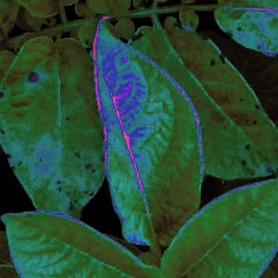

Full resolution source image

EXIF- image info
Filename – DSC00136_Sample__x492_y1840_.jpg
Make – SONY
Model – AgroWing_ILCE-QX1
Orientation – Top left
Date Time – 2017:07:12 13:10:43
Exif Offset – 124
Exposure Time – 1/250 seconds
FNumber – 6.00
Exposure Program – Shutter priority
ISO Speed Ratings – 100
Date Time Original – 2017:07:12 13:10:43
Light Source – Daylight
Focal Length – 25.00 mm
Focal Plane X Resolution – 235.17
Focal Plane Y Resolution – 235.84
Focal Plane Resolution Unit – No unit
GPS information:
GPS Latitude Ref – N
GPS Latitude – 52 36 55.287998 (52.615358)
GPS Longitude Ref – E
GPS Longitude – 16 37 51.296001 (16.630916)
GPS Altitude Ref – 436 (other)
GPS Altitude – 117 m
Present on Google Maps
Phenomenon Multispectral signature


Full resolution source image

EXIF- image info
Filename – DSC00136_Sample__x470_y1434_.jpg
Make – SONY
Model – AgroWing_ILCE-QX1
Orientation – Top left
Date Time – 2017:07:12 13:10:43
Exif Offset – 124
Exposure Time – 1/250 seconds
FNumber – 6.00
Exposure Program – Shutter priority
ISO Speed Ratings – 100
Date Time Original – 2017:07:12 13:10:43
Light Source – Daylight
Focal Length – 25.00 mm
Focal Plane X Resolution – 235.17
Focal Plane Y Resolution – 235.84
Focal Plane Resolution Unit – No unit
GPS information:
GPS Latitude Ref – N
GPS Latitude – 52 36 55.287998 (52.615358)
GPS Longitude Ref – E
GPS Longitude – 16 37 51.296001 (16.630916)
GPS Altitude Ref – 436 (other)
GPS Altitude – 117 m
Present on Google Maps
Phenomenon Multispectral signature


Full resolution source image

EXIF- image info
Filename – DSC00136_Sample__x408_y1308_.jpg
Make – SONY
Model – AgroWing_ILCE-QX1
Orientation – Top left
Date Time – 2017:07:12 13:10:43
Exif Offset – 124
Exposure Time – 1/250 seconds
FNumber – 6.00
Exposure Program – Shutter priority
ISO Speed Ratings – 100
Date Time Original – 2017:07:12 13:10:43
Light Source – Daylight
Focal Length – 25.00 mm
Focal Plane X Resolution – 235.17
Focal Plane Y Resolution – 235.84
Focal Plane Resolution Unit – No unit
GPS information:
GPS Latitude Ref – N
GPS Latitude – 52 36 55.287998 (52.615358)
GPS Longitude Ref – E
GPS Longitude – 16 37 51.296001 (16.630916)
GPS Altitude Ref – 436 (other)
GPS Altitude – 117 m
Present on Google Maps
Phenomenon Multispectral signature
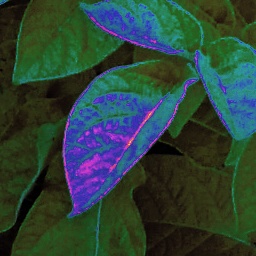

Full resolution source image

EXIF- image info
Filename – DSC00136_Sample__x376_y2306_.jpg
Make – SONY
Model – AgroWing_ILCE-QX1
Orientation – Top left
Date Time – 2017:07:12 13:10:43
Exif Offset – 124
Exposure Time – 1/250 seconds
FNumber – 6.00
Exposure Program – Shutter priority
ISO Speed Ratings – 100
Date Time Original – 2017:07:12 13:10:43
Light Source – Daylight
Focal Length – 25.00 mm
Focal Plane X Resolution – 235.17
Focal Plane Y Resolution – 235.84
Focal Plane Resolution Unit – No unit
GPS information:
GPS Latitude Ref – N
GPS Latitude – 52 36 55.287998 (52.615358)
GPS Longitude Ref – E
GPS Longitude – 16 37 51.296001 (16.630916)
GPS Altitude Ref – 436 (other)
GPS Altitude – 117 m
Present on Google Maps
Phenomenon Multispectral signature


Full resolution source image

EXIF- image info
Filename – DSC00136_Sample__x287_y1377_.jpg
Make – SONY
Model – AgroWing_ILCE-QX1
Orientation – Top left
Date Time – 2017:07:12 13:10:43
Exif Offset – 124
Exposure Time – 1/250 seconds
FNumber – 6.00
Exposure Program – Shutter priority
ISO Speed Ratings – 100
Date Time Original – 2017:07:12 13:10:43
Light Source – Daylight
Focal Length – 25.00 mm
Focal Plane X Resolution – 235.17
Focal Plane Y Resolution – 235.84
Focal Plane Resolution Unit – No unit
GPS information:
GPSLatitude Ref – N
GPS Latitude – 52 36 55.287998 (52.615358)
GPS Longitude Ref – E
GPS Longitude – 16 37 51.296001 (16.630916)
GPS Altitude Ref – 436 (other)
GPS Altitude – 117 m
Present on Google Maps
Phenomenon Multispectral signature


Full resolution source image

EXIF- image info
Filename – DSC00136_Sample__x282_y1790_.jpg
Make – SONY
Model – AgroWing_ILCE-QX1
Orientation – Top left
Date Time – 2017:07:12 13:10:43
Exif Offset – 124
Exposure Time – 1/250 seconds
FNumber – 6.00
Exposure Program – Shutter priority
ISO Speed Ratings – 100
Date Time Original – 2017:07:12 13:10:43
Light Source – Daylight
Focal Length – 25.00 mm
Focal Plane X Resolution – 235.17
Focal Plane Y Resolution – 235.84
Focal Plane Resolution Unit – No unit
GPS information:
GPS Latitude Ref – N
GPS Latitude – 52 36 55.287998 (52.615358)
GPS LongitudeRef – E
GPS Longitude – 16 37 51.296001 (16.630916)
GPS Altitude Ref – 436 (other)
GPS Altitude – 117 m
Present on Google Maps
Phenomenon Multispectral signature
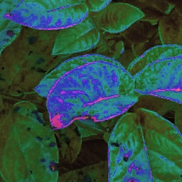

Full resolution source image

EXIF- image info
Filename – DSC00136_Sample__x188_y1660_.jpg
Make – SONY
Model – AgroWing_ILCE-QX1
Orientation – Top left
Date Time – 2017:07:12 13:10:43
Exif Offset – 124
Exposure Time – 1/250 seconds
FNumber – 6.00
Exposure Program – Shutter priority
ISO Speed Ratings – 100
Date Time Original – 2017:07:12 13:10:43
Light Source – Daylight Focal Length – 25.00 mm
Focal Plane X Resolution – 235.17
Focal Plane Y Resolution – 235.84
Focal Plane Resolution Unit – No unit
GPS information:
GPS Latitude Ref – N
GPS Latitude – 52 36 55.287998 (52.615358)
GPS Longitude Ref – E
GPS Longitude – 16 37 51.296001 (16.630916)
GPS Altitude Ref – 436 (other)
GPS Altitude – 117 m
Present on Google Maps
Phenomenon Multispectral signature
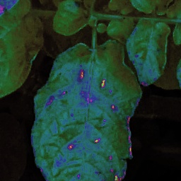

Full resolution source image

EXIF- image info
Filename – DSC00136_Sample__x152_y2980_.jpg
Make – SONY
Model – AgroWing_ILCE-QX1
Orientation – Top left
Date Time – 2017:07:12 13:10:43
Exif Offset – 124
Exposure Time – 1/250 seconds
FNumber – 6.00
Exposure Program – Shutter priority
ISO Speed Ratings – 100
Date Time Original – 2017:07:12 13:10:43
Light Source – Daylight
Focal Length – 25.00 mm
Focal Plane X Resolution – 235.17
Focal Plane Y Resolution – 235.84
Focal Plane Resolution Unit – No unit
GPS information:
GPS Latitude Ref – N
GPS Latitude – 52 36 55.287998 (52.615358)
GPS Longitude Ref – E
GPS Longitude – 16 37 51.296001 (16.630916)
GPS Altitude Ref – 436 (other)
GPS Altitude – 117 m
Present on Google Maps
Phenomenon Multispectral signature


Full resolution source image

EXIF- image info
Filename – DSC00136_Sample__x132_y1412_.jpg
Make – SONY
Model – AgroWing_ILCE-QX1
Orientation – Top left
Date Time – 2017:07:12 13:10:43
Exif Offset – 124
Exposure Time – 1/250 seconds
FNumber – 6.00
Exposure Program – Shutter priority
ISOSpeed Ratings – 100
Date Time Original – 2017:07:12 13:10:43
Light Source – Daylight
Focal Length – 25.00 mm
Focal Plane X Resolution – 235.17
Focal Plane Y Resolution – 235.84
Focal Plane Resolution Unit – No unit
GPS information:
GPS Latitude Ref – N
GPS Latitude – 52 36 55.287998 (52.615358)
GPS Longitude Ref – E
GPS Longitude – 16 37 51.296001 (16.630916)
GPS Altitude Ref – 436 (other)
GPS Altitude – 117 m
Present on Google Maps
